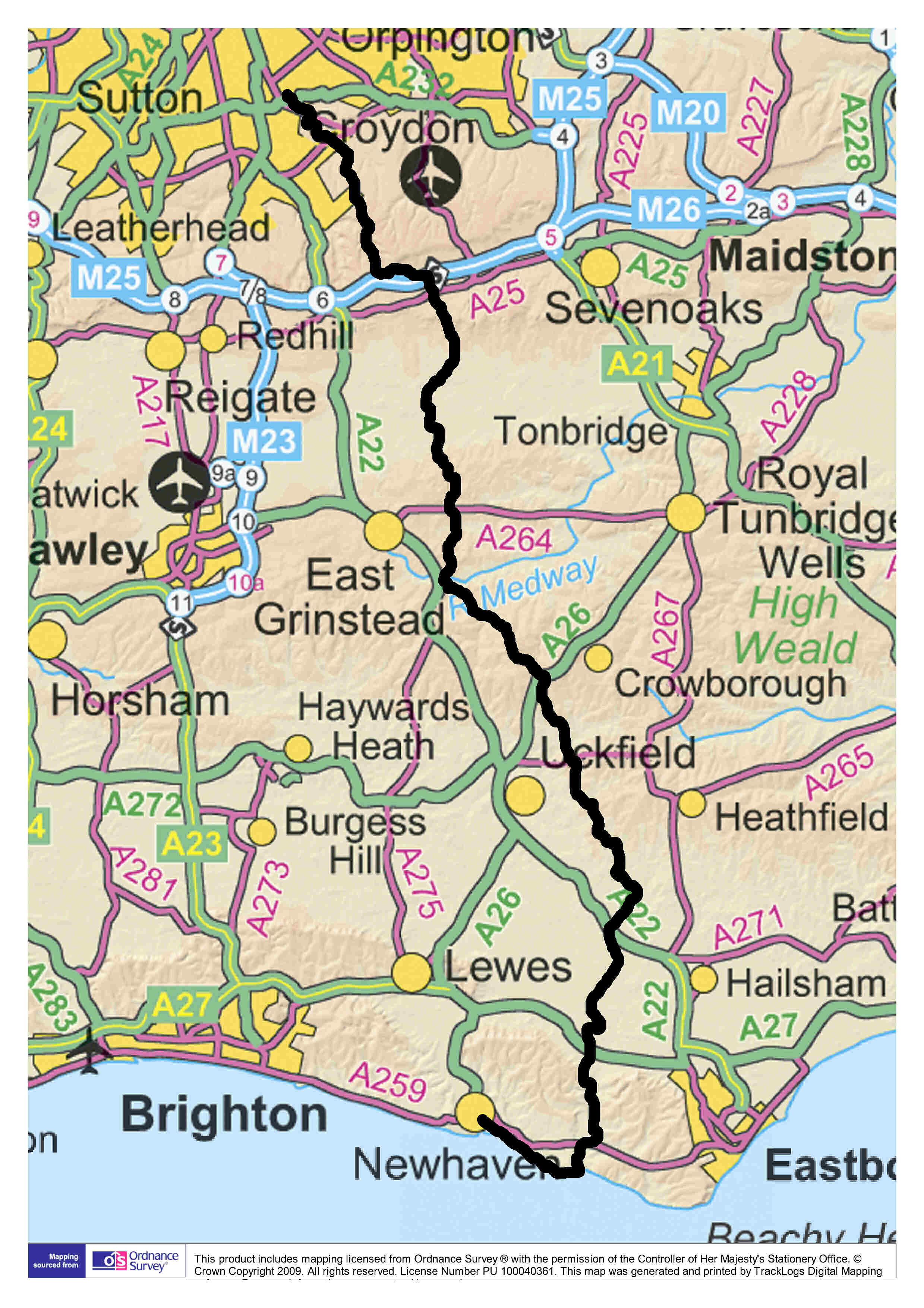
 The Vanguard Way is 66 miles (107 km) long. It starts on the southern outskirts
of Greater London and passes through the counties of Surrey, Kent and East Sussex.
On the Directions & Maps page
of this website you can find downloadable files giving directions and
maps from North to South (Croydon to Newhaven) AND from South to North;
there are also downloadable gpx files. From East Croydon Station, 20 minutes by train
from central London, you soon reach parkland, woodland and open country, passing
several historic houses at Coombe, through Selsdon Wood Nature Reserve and pass
the pretty little church of St. Mary the Virgin at Farleigh. Some quite
strenuous walking is needed to reach the highest part of the route, in the North
Downs, at 260 metres (853 feet) above sea level. On the way you pass the
mysterious Nore Hill Chalk Pinnacle - a feature that has been kept as a reminder
of the geological structure of this area.
A steep descent from the Downs leads on to the North Downs Way National Trail and the Pilgrims' Way, crossing the Greenwich
Meridian, where the Vanguards have provided a commemorative plaque. Nearby is Titsey Place, an 18th century manor house that can be visited at
certain times. Quickly crossing the M25 on a footbridge, a further ascent leads
into the wooded slopes of the Greensand Ridge.
In level farmland now, there is a Roman road followed by a steady climb to lonesome Dry Hill Camp, an Iron Age hillfort and English Heritage Scheduled
Monument, whose ramparts can still be seen.
A pleasant ridge walk leads to one of the few
large settlements along the route, Forest Row. This provides an opportunity to
replenish your emergency rations before venturing up into the Ashdown Forest -
actually a moorland in miniature. It's part of the High Weald Area of
Outstanding Natural Beauty and has associations with Winnie-the-Pooh.
The Vanguard Way enjoys a friendly rivalry with
the Wealdway, which runs vaguely parallel from Gravesend to Eastbourne, and the
two routes bump and scrape each other several times after their first encounter
in the Ashdown Forest.
Much of the southern half of the route follows
footpaths and bridleways through undulating fields and pastures well off the
beaten track. But the villages of Buxted and Blackboys offer some facilities,
and you may wish to admire the unusual style of High Hurstwood church, and the
millpond at delightful Tickerage Mill, once the home of actress Vivien Leigh.
You pass a 13th century church in the
tiny village of Chiddingly, and the Mohair Centre on
the way to Alfriston, once an important market town but now a pretty village
whose church (the Cathedral of the Downs), pubs, tea-rooms and specialist shops
draw many visitors.
Nearing the end now, the Vanguard Way joins the
South Downs Way National Trail to climb a spur of the Downs by means of two long
flights of steps. But what a view awaits you, of the meanders of the Cuckmere
River and the English Channel. You would be forgiven for thinking that this is
the finest view of the route, but you would be wrong, because soon afterwards
comes one of the most magnificent views in Britain: the chalk cliffs of the
Seven Sisters from Cuckmere Haven. We defy you not to keep turning round as you
climb towards Seaford Head, because many walkers think the view improves as you
get higher.
Finally, (now in company with the England Coast Path) it's level walking all the way to
Newhaven, but there are still things to enjoy: an ice cream or a pot of tea by
the beach at Seaford, its Martello Tower, and the fascinating Tide Mills - the
ruins of a forgotten village that is up for designation as a Scheduled Monument.
We hope this brief summary of the route highlights will convince you that the
Vanguard Way is well worth walking. A free set of guides and maps can be downloaded from this website and will tell
you all about these and many more interesting places, as well as provide details
of accommodation, pubs and teashops.
Happy walking!
|